An Ancient Map Resurrected: What Did Jerusalem’s Main Road Look Like 1500 Years Ago?
An archaeological excavation conducted by the Israel Antiquities Authority in 2010 near the Old City’s Jaffa Gate brought to life a c. 1500-year-old map.
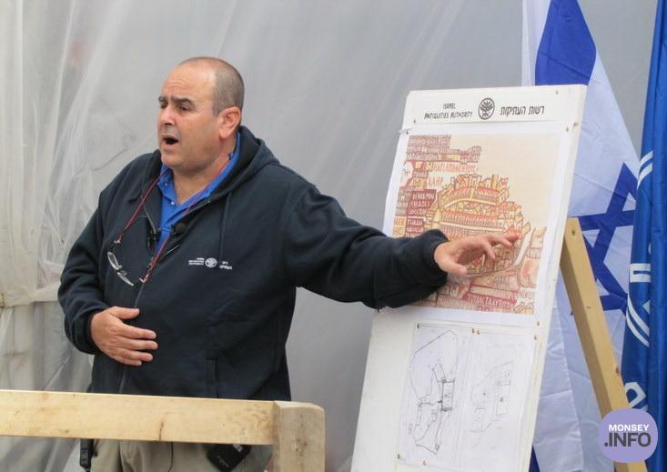
The Madaba Map is an ancient mosaic map that paves the floor of Saint George’s Church in the city of Madaba, Jordan. The map, created in the 6th –7th centuries CE, depicts the Land of Israel during the Byzantine period, and clearly shows the entrance into Jerusalem from the west via a central single gate that led to the main street of the city. In the past, the reliability of the map, which, among other buildings, provides the earliest visual description of the Church of the Holy Sepulchre, has been questioned. The excavation, located near David Street—known to tourists as the terraced shopping street—exposed for the first time, archaeological evidence of Jerusalem’s central street from about 1500 years ago. The salvage excavation, carried out in the wake of infrastructure works undertaken in the area and funded by the Jerusalem Development Authority, gave the archaeologists and the public a rare glimpse into the archaeological remains underlying the asphalt and the paving stones. Familiar with the Madaba Map, Dr. Ofer Sion, director of the excavation on behalf of the Israel Antiquities Authority, suspected that the ancient main street underlay the modern road. Indeed, “After removing a several archaeological layers, about 4.5 meters below modern street level, we were excited to discover the large stone slabs, each about one meter long, that were part of the ancient street. It’s great to see that today’s bustling David Street preserves the route of the Byzantine-period busy street from 1,500 years ago.”
Bonus facts: The Madaba Map, whose extant part measures 16 x 5 m, depicts the land of Israel as known to the mosaic artist. The map encompasses the entire country, with emphasis on Jerusalem and its Christian sites, and shows that many churches were first constructed in Jerusalem during this period, when the city underwent a religious transformation from a pagan to a Christian city. The churches can be identified by their red tiled roofs illustrated on the map.
You don’t have to travel all the way to Jordan to see the fascinating map, as, just recently, a replica of the Madaba mosaic, created by the Israel Antiquities Authority Conservation Department’s mosaic experts, was installed at the Tower of David Museum in the Old City of Jerusalem.